This site uses first and third-party cookies to save information on your computer. Click here to find out which cookies are used on this website. Some of these cookies are essential for using our site, others help improve your user experience, and some may be used for advertising purposes (targeting/advertising cookies). If you would not like us to save third-party cookies on your computer while you are using this site, please click the “I do not consent” button. You can consent by clicking on the “I consent” button. At any time, you can withdraw your consent by contacting us at: privacy.support@climate.com. I consent I do not consent


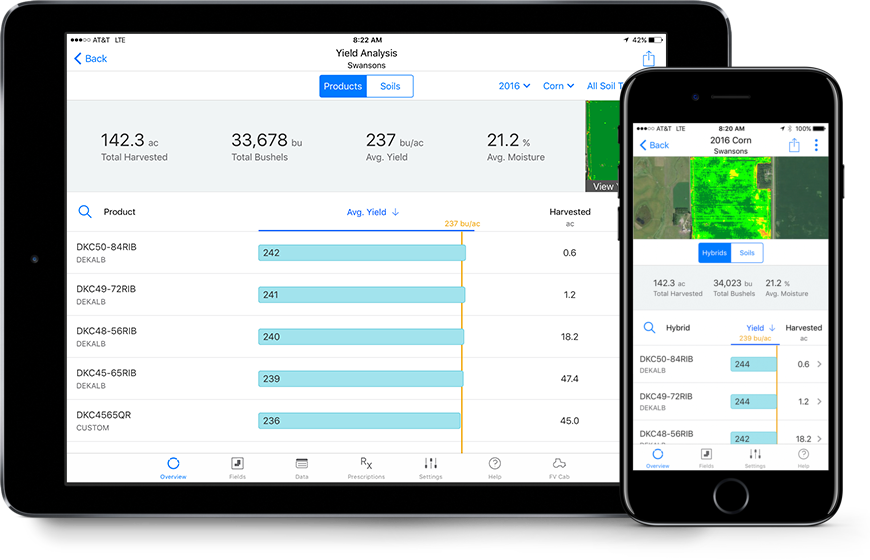
Evaluate crop performance
Use digital maps to compare critical field data layers and determine how agronomic practices can impact yield. Generate crop performance reports and pick the best seed for next season.
Compare Maps Side‑by‑Side

Yield Analysis

Field Region Analysis

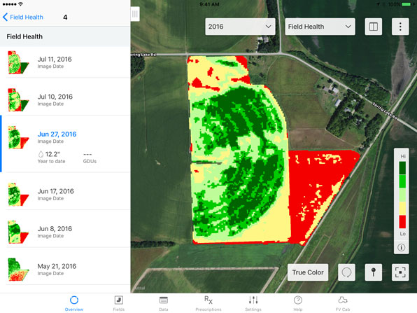
Stop problems before they start
Find out what’s happening beyond the end rows with imagery that can help you identify issues early and prioritize scouting. Climate FieldView™ uses a proprietary process to deliver consistent, high-quality satellite images so you can identify in-season challenges and take action to protect yield.
Prioritize scouting activities

IDENTIFY ISSUES EARLY


